

Here’s some mapping I’ve been meaning to run since reader Peter mentioned it in the comments to the post ‘Keep out of Cotterill’s road‘ on Friday last. I may have posted similar before, but if I have, I can’t find a copy.
In that post, there’s a fragment of map which historian Gerald Reece found back in the 1990s when researching his book ‘Brownhills A walk into history’. The map section is from the first large mapping carried out by the Ordnance Survey, whose date is argued hotly and shows clear variance across the countrywide plot. Of course, this is to be expected, as the project was huge and would have taken years to complete.
Gerald pointed out that the map of Ogley Hay predated Inclosure and showed the pre-Cotterill road system. This mapping is now accessible in digital form, and I’ve used sections of it before, notably in my post about Goblin’s Pit. Since Peter was so interested, I thought I’d go for a wider area so there would be plenty of interest.
In answer to the specific questions, as fellow reader Clive points out, the Tonnage House was the toll point on the canal, where boats were gauged for weight and charged accordingly. A later (or possibly the same!) incarnation of it is shown in this post on the Black Cock Bridge; I think it’s the hut the bicycle is leaning against behind Alf Mole and his workmates.
The Machine House is a mystery, but as this was the time of shallow mining on the common nearby, I suspect it was a pumping engine.
Take a long look at this map; it shows how names evolve and disappear. It’s a beautiful thing.
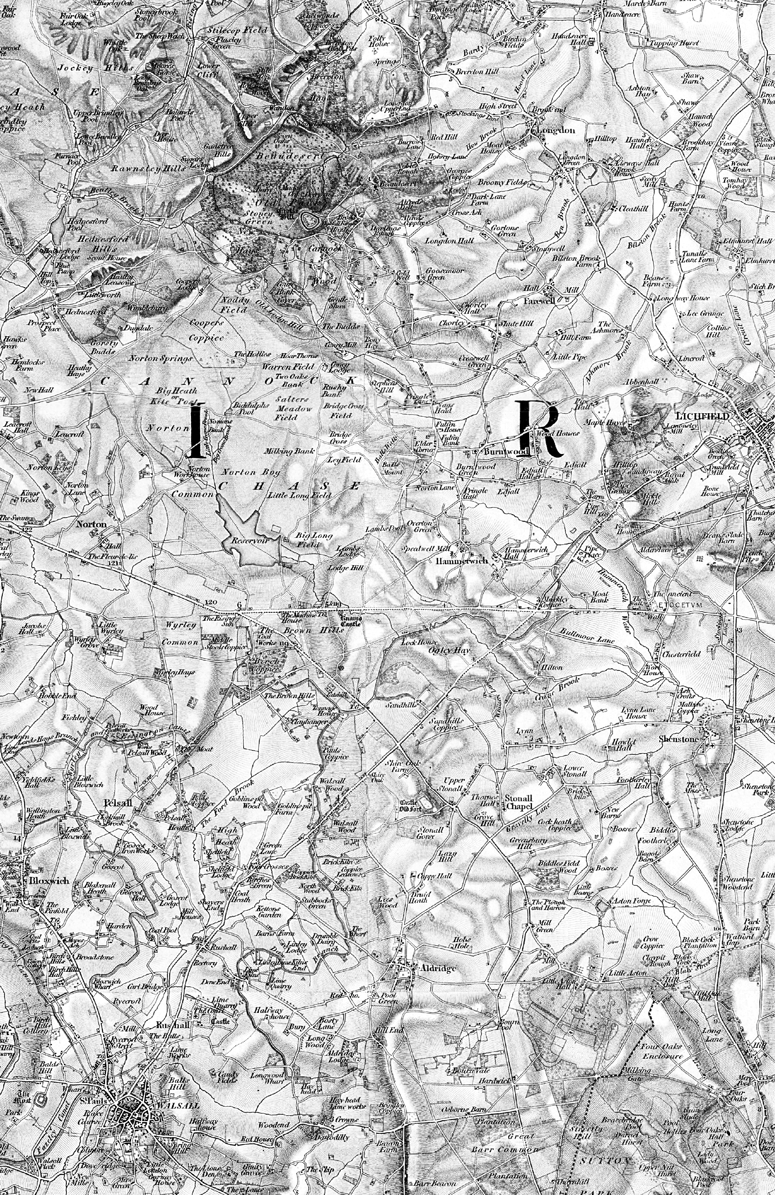
This is about 1:50,000, and is the first Ornance Survey mapping of our area produced. As Gerald Reece points out, it predates the 1938 Inclosure of Brownhills. Click for a much larger version – it’s a very big image, so please be patient.