
There has been some recent discussion here of the old railway line and former Brownhills West station that used to cross Brownhills Common from Walsall Wood, dismantled in the sixties. A couple of weeks ago, I took a trip up the old line to see what remained of the industrial past.
For the exact location of each image, click on it and you’ll be able to see it pinpointed on the relevant Panoramio page.

The Beacon Way follows much of the line of the old railway. Here existed an underbridge where the railway dived under Watling Street. 6:02pm, Saturday, 31st July 2010.

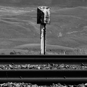
Although almost totally obscured, one can still detect the flatness and hard bed of a railway. 6:06pm, Saturday, 31st July 2010.

Toward the Chester Road, the embankment and remnants of a station are still evident. 6:08pm, Saturday, 31st July 2010.

This retaining wall was clearly internal to a building, it was painted white with stout buttresses. 6:09pm, Saturday, 31st July 2010.

This gate was at the original entrance of Brownhills West station, just beside the Chester Road. 6:12pm, Saturday, 31st July 2010.

Where the brickwork sticks out, the bridge used to stand. All the blue brickwork here is original. The footpath beside the Chester Road has always been at a much lower level than the road itself; speculation suggests the road height may have been increased since removal of the bridge to prevent flooding. 6:13pm, Saturday, 31st July 2010.

The former arch wall still bears it's identity mark. 'BRB' stands for 'British Railways Board'. 6:13pm, Saturday, 31st July 2010.

Fascinating and unusual pictures of Brownhills West Station from the excellent book by Clarice Mayo and Geoff Harrington, 'Memories of Brownhills Past'.
 RSS - Posts
Pingback: Station mastery | BrownhillsBob's Brownhills Blog