

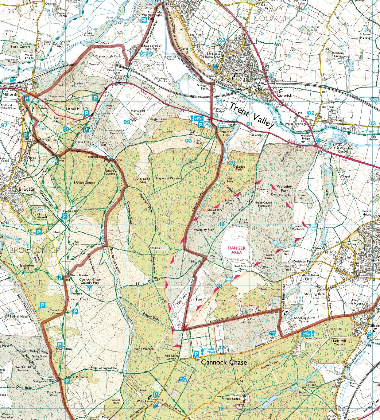
On Wednesday, I published a ride video on my 365daysofbiking Tumblr journal of a ride from Brocton Field on Cannock Chase to the car park at Milford Common, mainly along the Sherbrook Valley. It’s the same ride upon which I took those pictures of the remarkable sunset I also posted yesterday.

Blog reader and ride video fan Andy Hanson asked on Facebook if I had more details of the route I took. Well, I used Memory Map and laid out the GPS trace over an OS pathfinder map to show the section in question.

- My route as recorded by GPS. The vide is compiled from recordings made between Brocton Field (near the Glacial Boulder), and Miford Common. The section in the dark was from Seven Springs to Kingsley Wood Road. Click for a larger version.
For clarity, I’ve uploaded the entire route to Bikely, so it can be explored in full (except the identifying bits, naturally). Bikely isn’t the most reliable service, so please try again later if the link fails.


My route at Bikely - click on the image to visit the route on the site itself - you can download a copy there for your own GPS device or smartphone. Not the most reliable service, but great when it works.
If anyone would like more information, please don’t hesitate to ask.