

Top Canal and River Trust operatives look for a leak. Image Kindly supplied by Andy Bennets.
Several people have brought to my attention in recent days the falling level of the local canal in Brownhills and surrounds, which has naturally been causing concern, particularly following the recent wet weather which saw the canal overflowing heavily on Sunday, 27th May 2018.
By yesterday afternoon (Saturday, 2nd June 2018), I measured the level as 144mm lower than the overflow height at Clayhanger: Nearly six inches of water lost in five days from about 25 miles of canal at the same level with no locks is a huge amount of water to disappear without obvious trace.
9pm last Sunday evening (27th May 2018). This canal was not short of water then…
Initial enquiries with the pretty useless PR people at the Canal and River Trust blamed Staffordshire County Council for turning off the supply of water from Chasewater, which was clearly arrant toss as it had been running since April.
Hi all, sorry to just get back to you. It was an issue where the local council who control the valve on Chasewater turned it off without us being aware. Our teams are on the case and pumping water from Bradley to try and bring levels back up. -Amy
— CRT Customer Service (@CRTContactUs) June 1, 2018
Online discussions had centred around someone perhaps leaving a lock sluice open, as so much water leaking would surely be evident somewhere. As incidents at Middlewich and Llangollen show, canals leaking so much tend to be catastrophic and very evident!
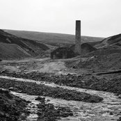
In the early 1980s, a breach at Sandhills near Anchor Bridge, Brownhills caused much damage, too.

Oh dear. Clcik image to see original stoppage notice. Chasewater my eye.
It turns out that from an emergency stoppage notice posted yesterday (Saturday 2nd June 2018) water has been leaking from the canal into a stream culvert at Little Bloxwich, and thankfully hasn’t burst through. Work is currently underway to isolate the section and repair it, damming the canal to prevent water loss in the interim.

On Thursday evening, at Clayhanger the drop was 123mm from the Clayhanger overflow level.
Hopefully this should see levels stabilise in a short time.
This incident has further convinced me that the Canal and River Trust couldn’t find their arses with both hands, an arse map, a mirror, a team of very expensive arse finding consultants and an example arse flown in from America.

Clcik image to visit Andy’s blog and read his take of the amazing sinking canal.
Thanks to everyone who brought this to my attention and debated it: great stuff.
If you have a view on this, or pictiures, please do get in touch. Comment or mail me: BrownhillsBob at Googlemail dot com. Thanks.
 RSS - Posts


Subject: Navigation closure notice: Wyrley & Essington Canal, Navigation: Closed, Towpath: Open
Notice Alert
Wyrley & Essington Canal
Starts At: Teeces Bridge
Ends At: Teeces Bridge
Up Stream Winding Hole: North of Teeces Bridge use the junction with the Cannock Extension Canal
Down Stream Winding Hole: South of Teeces Bridge use Birchills Junction
Saturday 2 June 2018 13:00 until further notice
Type: Navigation Closure
Reason: Structure failure
Original message:
A culvert that runs below the canal has collapsed and the level of the canal is continuing to drop so we need to isolate the section with the leak to protect the remainder of the canal.
Please note the Northern and Southern Sections of the canal are all open and can be accessed via the Tame Valley and Rushall Canals or either the Walsall canal or Wolverhampton Main line.
You can view this notice and its map online here:
https://canalrivertrust.org.uk/notice/13210/teeces-bridge-stoney-lane-little-bloxwich-wyrley-and-essington-canal
You can find all notices at the url below:
https://canalrivertrust.org.uk/notices
That is actually in the post…
This could account for the fact that the stream running through Grenfell Road allotments is overflowing and flooding the fields off Wolverhampton Road.
This is probably the reason why the stream running through Grenfell Road Allotments is still over flowing its banks and the fields along the Wolverhampton Road next to it are also flooded.
The canal is now down after refilling 235mm at Becks bridge in Brownhills !! Called CRT emergency no says someone will be back to us immediately and still waiting 2 days later !!
Our boat is completely grounded so can’t go anywhere and paying a fortune to CRT !!!
i am surprised that a drop of 200mm is grounding barge’s. Always imagined a bit more clearance under the vessels. Seems like the future of our waterways are not in the safest of hands.
In a 1200mm depth kept clear by passing boats, 17% of the depth is a huge amount to lose. At the sides particularly, the grounding risk is real.
Bob
Pingback: The fall and rise: Fixing a hole in the cut begins | BrownhillsBob's Brownhills Blog