

A grim scene at a Wolverhapmpton Coal Wharf, thought to be 1960s, kindly supplied by Anthony Martin. Please help me locate this remarkable image.
Reader, contributor and historic transport wise-owl Tony Martin has been in touch with an intersting photo of a canal coal wharf in Wolverhampton, thought to be early 60s. I can’t actually place this at all mentally, although I must have cycled past it loads of times. Can anyone help? Is this Wulfruna Coal on the Walsall Road, perhaps?
Hello Bob
Another find in my collection.
Taken sometime in the early 1960s, probably by my father, this is a view from the approach to the, then, High Level station, an area since erased by the Wolverhampton Ring Road.
The boat is the Comet, which still exists. Notice the sate of the ground and total lack of shelter from the pouring rain. Who would work in these conditions today?
A little off-topic, but the coal probably came from the Chase or Angelsey Wharf, perhaps?
Tony Martin
Tony is quite right, Comet is still about and in fine fettle, as this image on Flickr shows:

Image from the Flickr photo stream ‘Historic Narrowboats’ – click on the image to go explore some great images.
This raises a good point; we’ve talked extensively about Anglesey Wharf, and explored it at great length, but there were coal wharves all along the local canals. What do we know about them, and where our coal went? I know a lot of it went to Walsall Power Station along the canal, but what images and history do we have for transfer points at pits and other places?
I’d be interested to explore that – we’ve not really touched on it much.
Tony also supplied a few weeks ago some great pictures from the Chasewater Railway Gala Weekend. Much of our coal would have ended up powering such locomotives – where did the railways store this coal and accept deliveries from?
Thanks to Tony, as ever for yet another great contribution. Anything to add? Comment here or BrownhillsBob at Googlemail dot com. Thanks.
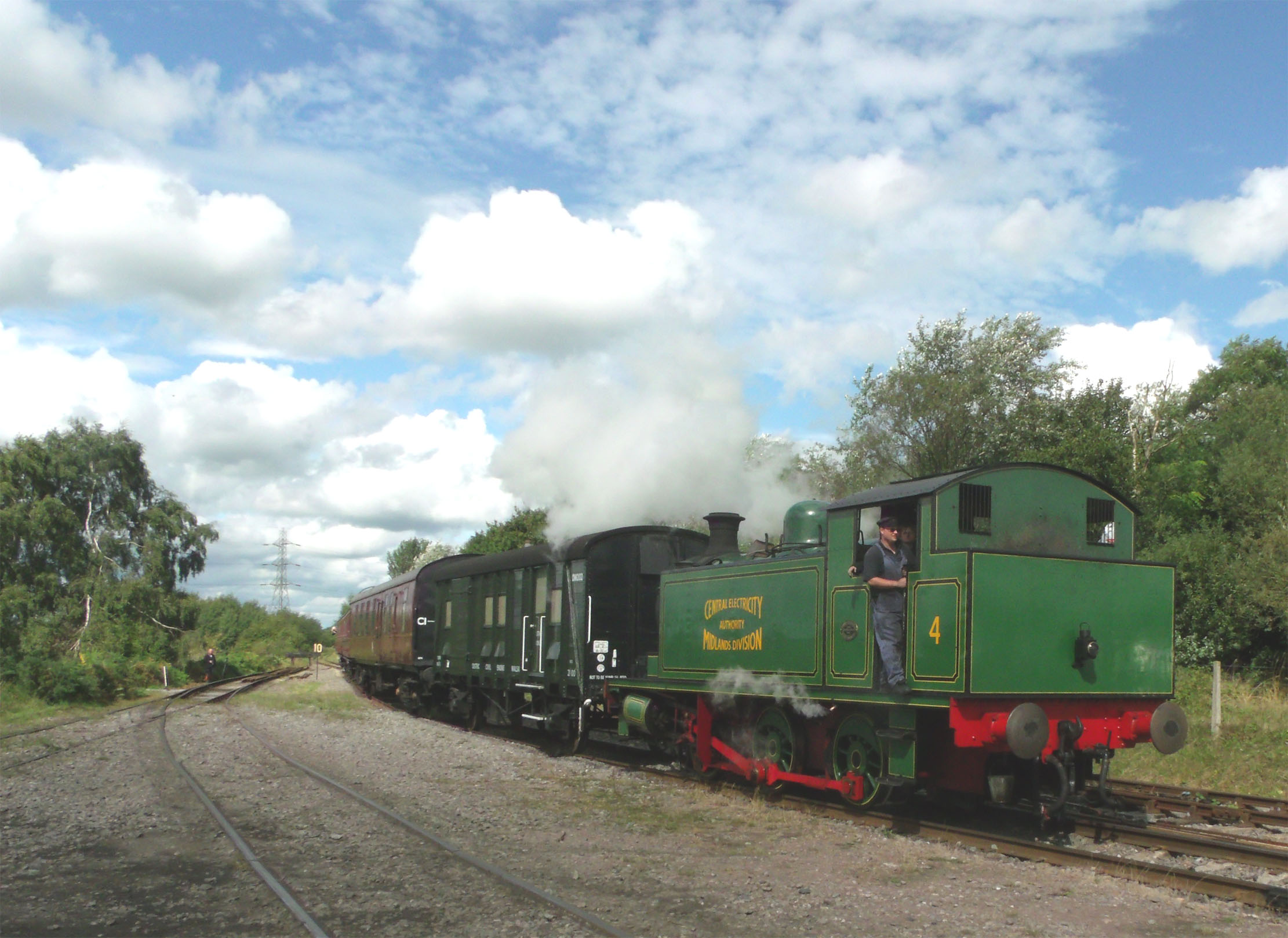
From Chasewater Railway gala day. Hopefully, Tony can help with the ID of this loco.

From Chasewater Railway gala day. Hopefully, Tony can help with the ID of this loco.
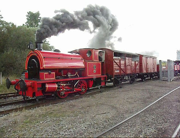
From Chasewater Railway gala day. Hopefully, Tony can help with the ID of this loco.
 RSS - Posts


The wall along the right hand tow path, and how it angles up towards the end of its run, the bridge, with possibly a little basin beyond it, those two large buildings just past the bridge… Not 100% certain but it looks very very similar to the stretch of canal that runs to the right hand side of the Ring Road just before Wednesfield Road. That would put the put the railway lines out of site over the right of the buildings and warehouse/unit, and Railway Drive behind the photographer. The larger buildings just past the basin bridge would be the Canal Club today. The bridge ironwork is unchanged, just a different colour now.
Excuse the typo’s – and I really do know how to spell “sight” !
The bridge on the right looks like the entrance to the Wharf at Broad Street…
http://www.geograph.org.uk/photo/712660
Yep, that’s the one I thought it was.
https://maps.google.co.uk/maps?hl=en&ll=52.588026,-2.122011&spn=0.001604,0.003098&t=h&z=19
Another source says…
“Broad Street Wharf, South of Wednesfield, road originally belonged to the Shropshire Union Railway and Canal Company formed in 1846, who acquired offices on the site.”
On the google image the offices may be still there. The reddish building at the end of the Wharf?
All the best Pedro
Old Broad St. bridge (now at Black Country Museum, coal wharf is F&B coal co. Comet was probably then being run by willow Wren, right picture BW Broad St Depot, formerly Fellows Morton & Clayton pre 1948, boats loaded with D/S nuts, could be Grove, or Cannock wood via Anglesey; if the boats were for some obscure reason loading at the wharf, you could also include Littleton, Mid Cannock or at a pinch, Baggeridge by road to F&B, I would say it was likely to be a local (BCN )boat job in view of the day boat
A great write up of this area is given here…
“One of the main wharves in the town centre was Can Lane Wharf and basin, which is shown on the map as a very short basin, opposite the entrance to Adams’s basin.
There was also an entrance to the canal at the junction of Can Lane and Broad Street, which was used by some of the packet boat companies that took passengers to and from Birmingham. This area, later referred to as Broad Street Wharf was used by coal merchants Beebee Brothers in the 1930s…”
http://www.historywebsite.co.uk/Museum/OtherTrades/BCN/CHtoBroadStBasin.htm
The canal view was from the approach to the, then, High Level station, looking towards the Wednesfield Road bridge, as Gabriel states. Between here and the town centre, to the left on the photo, there was a small bus station. All long swept away by the Ring Road.
Comet of Stroudwater Carriers Ltd between 1974 and 1976 summer with Ian Kemp who was relieving Yours Truly – Jim Marshall. If you need exact date you’ll have to wait until I’ve emptied my current boat in Hackney……and I’ve dug out my diary!!!!
Apologies for misleading you folks and to Jim, listen to Jim on the subject of Comet
Pingback: Now and then | BrownhillsBob's Brownhills Blog
Regarding the picture of Comet, is the boat this side of it a ‘hampton’ boat ? it looks much longer than Comet ?
sorry its so late but yeah it definitely looks like a hampton.