

Huge post alert. This has taken a bit of work to pull together, but I think you’ll agree that it’s a bit of a cracker. The young David Evans has done some great physical geography stuff before, notably his pursuance of the brook at Brook Lane and Sunnyside, near The Vigo. This time he hunts for a ridge known as the Vigo Fault, a geological feature that was a headache for local miners and proved troublesome for the local council.
Thanks to David, as ever, and a special hat tip to Brian Rollins, whose fascinating map kicked the whole thing off. You can get a copy of Brian’s book from the Cannock Chase Mining Historical Society, as well as other local history sources.

A amp showing the location of the major geological faults in north Aldridge, Waslall Wood and Clayhanger. The Clayhanger Fault is highlighted in blue and the Vigo Fault in red. Image from Brian Rollins ‘Coal mining in the north east section of Walsall Metropolitan Borough’. Click for a larger version.
The above map appears on page on page 57 of Brian Rollin’s book, ‘Coal mining in the north east section of Walsall Metropolitan Borough’ which was published in 2006.
I was attracted to this plan showing the two geological fault lines that form the approximate oval shaped boundary of the coalfield in Walsall Wood
But the plan only gives an approximate location. Given that the Clayhanger fault line may be difficult to find and identify, I wanted to see if the Vigo fault extended up to the surface and be visible in some way.
So I walked from Castle Road to where the Lichfield Road and the original Holly Lane meet. As the area is now a housing estate and on the side of a gently sloping hill, perhaps there might be some indication in road surface distortion, or unusual change in the slope, or even some distortion in walls that could suggest the location and surface presence of this fault.
The first image is a 1930s postcard view looking up Castle Road. On the left the newly built council houses.

Looking up Castle Road on a 1930s postcard, as featured in Jan Farrow’s book ‘Brownhills and Walsall Wood on Old Picture Postcards’.
The present view shows that one of these houses is missing.

Looking up Castle Road today, as captured by David Evans. The key to this is the white houses, on the right.
The road surface and slope seems to be different, also. Looking across the road, over the yard and back toward Aldridge, the roofline of an old garage here is interesting.

Interesting roofline, and interesting motor. Also, to the sign writer, you had one job. Just one… Picture by David Evans.
Is this where the Vigo fault is to be found?
In nearby Castlefort Road and just behind the missing house, more houses were demolished. This is the garden of one of those houses.

All that remains… Image supplied by David Evans.
Just across the road from here, on the corner of Fort Crescent, empty spaces where more houses were demolished, some years ago.
(This has been covered before in an article here, and some recent material supplied by a reader.

Interested to note Councillor Burt, a well-knwn figure of the time. Taken from The Walsall Observer, Friday, February 18th, 1977.
Recently, friend of the blog Peter has emailed to comment on the green here, and the missing houses of Fort Crescent.
Bob,
You posted an article maybe 18 months ago, which I’m sure was entitled Sink Estate.
The theme of the article was an old photograph originally published in one of the local rags detailing the demolition (or soon to be demolition) of old Council houses on a patch of land at the back of the Brickmakers Arms known locally as the green, in the Walsall Wood/Vigo area.
Well, the attached photographs show where some of them might have actually stood, only when the weather is very dry and the grass is starting to shorten does an eerie ghost of foundation start to appear, there hasn’t been a sighting for a couple of years now but here they are (well 2 of them) in some glory.
Keep up the good work.
Peter.
Peter included the following great photos:


That’s real psychogeography, right there. Tamworth Timehikes would be very, very proud… Thanks to Peter for the great spot.)
David continues:
Looking down Castlefort Road towards Salters Road, road we can see a visible drop in the road surface – the lost houses of Fort Crescent would be on the right, beyond the salt bin.
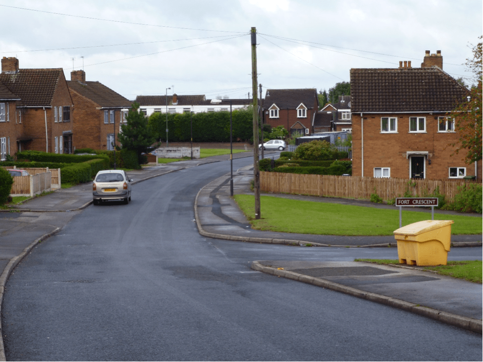
Image kindly supplied by David Evans.
There seems to be pattern, and a line developing. In nearby Beacon Way, just off Salters Road, there is the same sudden gradient in the roadway.
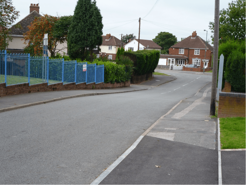
Image taken by David Evans.
(I took note of this, and pulled it up in Google Maps. David is quite correct, there is a clear line in the physical geography of development. – Bob)

Imagery from Google Maps clearly shows a line through the Castlefort/Holly Bank estate. Please click for a larger version.
To complete my exploration, I went to where Holly Lane and Lichfield Road once met – where the Shire Oak tree stood. The footpath in Lichfield Road here shows signs of a sudden gradient, over which the road has been later re-profiled.
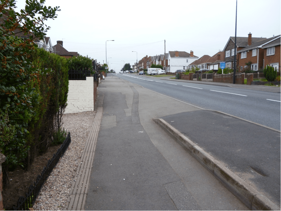
Image by David Evans.
From here, the ridge appears to run over the old school fields (partially now the site of a modern housing estate) and along Commonside. I did not walk that section of what may be the Vigo fault. I know that the school sports fields were re-profiled to provide the sports pitches, and this has given a marked bank in the slope there, which could be misleading.
(Intrigued by this observation, I resorted to Google Streetview. This is very interesting. If one follows Commonside northwards from Friezland Lane, The houses on the left – east side – are clearly higher than those on the right; also, the school field slopes down here to the road in a very marked way. – Bob)

But, somewhere along here was an area known in the oldest days of Walsall Wood was ‘The Cape’. I wonder if this referred to some drop in the surface many years ago, and possibly well before the local coalmining began. Is ‘Cape’ perhaps a derivation of another word?
David Evans, September 2013